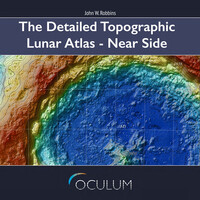
he Detailed Topographic Lunar Atlas is here - a most detailed atlas of the Moon, showing the entire lunar surface in high resolution as you have never seen before! The Moon is divided into two atlases: a near side and a far side atlas. This is the near side edition. The atlas consists of 1204 individual topographic maps covering the entire near-side of the Earth’s Moon and providing graphical representations of the Moon’s surface at unprecedented levels of detail. A scale of 1:500,000 was adopted for all maps, with the exception of the polar maps which were set at 1:800,000. The maps were created on the basis three lunar Digital Elevation Models (DEMs) developed by NASA. The maps include names and labels for: - 6 Manned lunar landings - 51 anthropological features of various nature - 915 main craters - 5418 satellite craters - 11 crater chains (catena) - 51 oceans, seas, bays, lakes and ponds (oceanus, mare, sinus, lacus and palus) - 54 mountains and promontories (mons, montes and promontorium) - 131 valleys and fissures (vallis and rima) - 46 ridges and escarpments (dorsa and rupes) - 1141 dome features A comprehensive index lists all named formations. The PDFs can be easily navigated within PDF-readers or e-readers. Remarkable detail can be seen when maps are zoomed-in. Sample images (at left) have been down-sampled, but maps in atlas are displayed with more detail.