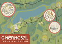
The Chernobyl reactor disaster on April 26, 1986, represents one of the most drastic events of the 20th century. An accident of this magnitude was unimaginable in nuclear technology until then. The catastrophe radically changed the lives of very many people. Only thanks to the efforts of hundreds of thousands of liquidators was it possible to gradually contain the widespread radioactive contamination. Many paid for their efforts with their lives. To protect the population living in the region around the power plant, villages and settlements were evacuated and in some cases completely razed to the ground. About 350,000 people were resettled from the area declared an exclusion zone. In addition to the photos of the damaged power plant, the pictures of the abandoned town of Prypyat, once home to almost 50,000 people, went around the world and left their mark on an entire generation. Since the closed zone around Chernobyl opened to controlled tourism in 2011, more and more adventurers, photographers and interested people are also visiting this special non-place. This useful folded map provides short background information about special sites within the restricted zone (among others: Chernobyl nuclear power plant, Ghosttown Prypyat and the DUGA-OTH-Radar), information about the catastrophe itself and details about the current sightseeing opportunities. An illustrated map on the front side clearly visualizes the individual sites that can be visited as part of day trips and multi-day trips.